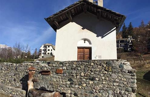
Passeggiate ed escursioni a Sauze d’Oulx
Sauze d’Oulx è il punto di partenza ideale per gli amanti del trekking: centinaia di chilometri di sentieri segnalati ti aspettano, dalle cime più alte alle passeggiate rilassanti nel cuore del Parco Naturale del Gran Bosco. Ce n’è per tutti i gusti e livelli: principianti, famiglie e trekker esperti.
Per orientarti al meglio, puoi trovare cartine, guide e libri dedicati ai percorsi presso l’Ufficio del Turismo e nelle edicole di Sauze d’Oulx e Jouvenceaux.
Vuoi pianificare in anticipo le tue escursioni? Scopri tutti i tracciati su OUTDOORACTIVE, la piattaforma gratuita dove puoi consultare mappe dettagliate, scaricare le tracce GPS e accedere a tutte le informazioni utili sui sentieri della zona.
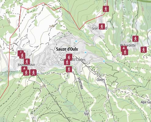
Mappa Interattiva dei Percorsi
Questa mappa interattiva offre una panoramica dei percorsi consigliati a Sauze d’Oulx.
Scegliete sempre i percorsi che siete in grado di affrontare fisicamente e assicuratevi di comunicare a qualcuno dove state andando e quando intendete tornare.
Visualizza la qui mappa interattiva delle escursioni.
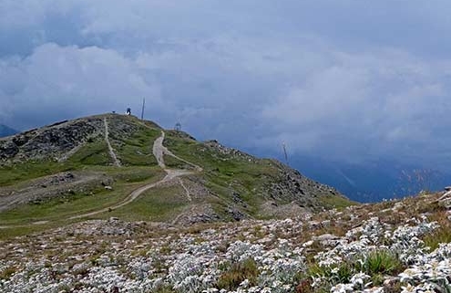
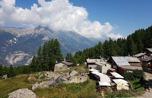
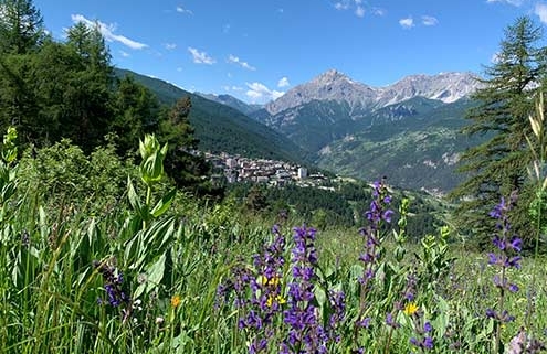
Esplora alcune delle passeggiate più conosciute di Sauze d’Oulx
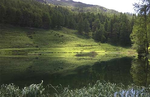
Lago Laune – Ferro di Cavallo
Difficoltà: facile
Distanza: 1.1 km
Durata: 0:30 h
Salita: 120 m
Il più alto: 2,170 m
Il più basso: 2,050 m
Testa dell’Assietta – Strada dei Cannoni
Difficoltà: media
Distanza: 10.1 km
Durata: 3:30 h
Salita: 765 m
Il più alto: 2,560 m
Il più basso: 1,795 m
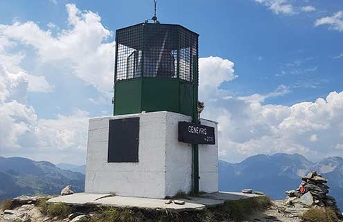
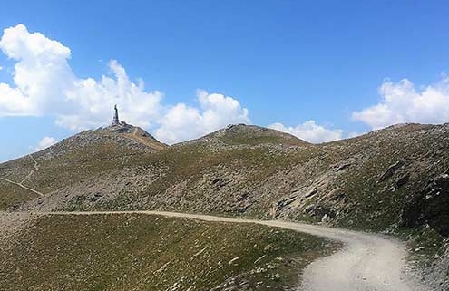
Lago Laune e Monte Genevris
Difficoltà: difficile
Distanza: 4.9 km
Durata: 2:30 h
Salita: 700 m
Il più alto: 2,535 m
Il più basso: 1,850 m
Richardette – Ciao Pais
Difficoltà: media
Distanza: 1.7 km
Durata: 1:00 h
Salita: 210 m
Il più alto: 1,904 m
Il più basso: 1,694 m
Richardette – Monte Genevris
Difficoltà: media
Distanza: 4.0 km
Durata: 3:00 h
Salita: 820 m
Il più alto: 2,535 m
Il più basso: 1,695 m
Tachier – Malafosse Alta
Difficoltà: facile
Distanza: 3.1 km
Durata: 1:15 h
Salita: 270 m
Il più alto: 1,810 m
Il più basso: 1,540 m
Gran Villar-Richardette
Difficoltà: media
Distanza: 2.6 km
Durata: 1:30 h
Salita: 348 m
Il più alto: 1,868 m
Il più basso: 1,519 m
Clotes-Sportinia
Difficoltà: media
Distanza: 5.2 km
Durata: 2:15 h
Salita: 605 m
Il più alto: 2,135 m
Il più basso: 1,530 m
Barracan
Difficoltà: facile
Distanza: 2.5 km
Durata: 1:15 h
Salita: 190 m
Il più alto: 1,575 m
Il più basso: 1,380 m
Carte escursionistiche 1:25.000
Cartine, libri e guide della zona si possono trovare e acquistare presso l’Ufficio del Turismo e le edicole di Sauze d’Oulx e Jouvenceaux.

IGC 105 Sestriere – Claviere

IGC 104 Bardonecchia – Sauze d’Oulx

Fraternali 2 Alta Valle Susa
Link a: Ski Area & Piste Map
Hiking Monte Genevris
Link a: Bicycle Hire
Noleggio Bici
Noleggio E-bike, Downhill, MTB a Sauze d’Oulx
Link a: Mountain Biking

MTB
MTB Sauze d’Oulx
Link a: Jogging & Trail Running

Jogging/Trail Running
Jogging e Trail Running a Sauze d’Oulx
Link a: Strada dell’Assietta
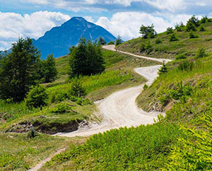
STRADA DELL’ASSIETTA
Un meraviglioso percorso di montagna
Link a: Natural and landscape resources

GRAN BOSCO
Gran Bosco Natural Park
Link a: Adventure Village
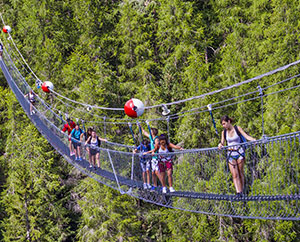
ADVENTURE VILLAGE
Adventure village e ponte tibetano
Link a: Hotels
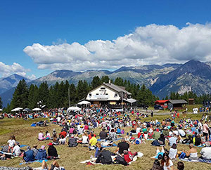
Eventi estivi
Eventi estivi a Sauze d’Oulx
Link a: Hotels
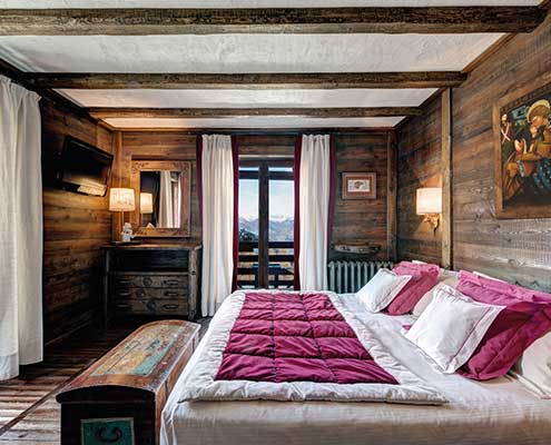
Hotel a Sauze
Hotel a Sauze d’Oulx
Link a: Places to Visit

Cosa visitare
Attrazioni vicino a Sauze d’Oulx
Link a: Bicycle Hire
Noleggio Bici
Noleggio E-bike, Downhill, MTB a Sauze d’Oulx
Link a: Freeride
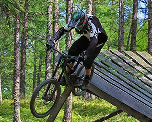
Freeride/Bike Park
Sauze Bike Park
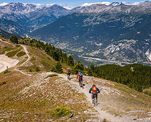
Link a: Mountain Biking
MTB
Sauze d’Oulx MTB
Link a: Road Cycling

Bici da Strada
Bici da strada informazioni
Link a: Strada dell’Assietta
STRADA DELL’ASSIETTA
Mappe e informazioni
Link a: Natural and landscape resources
GRAN BOSCO
Parco Naturale Gran Bosco