OFF-ROAD
IN THE HIGH SUSA & CHISONE VALLEYS
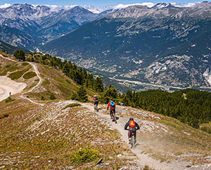
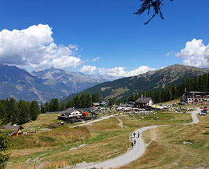
The old military roads which wind through the valleys, plateaus, villages and high alpine pastures of this part of Italy, are a favourite location for off-road motorcyclists and 4X4 vehicles along with hikers and cyclists.
The Vie Storiche di Montagna (Historic Mountain Routes) that connect the Susa and Chisone valleys are a true landscape and environmental heritage and provide unique experiences and spectacular viewpoints.
Visit Piemonte: The Historic Mountain Roads
OFF-ROAD INFORMATION
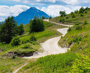
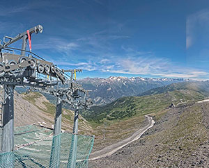
The former military roads in this area of Italy offer some of the best off-road riding and driving in the Alps.
The most famous, the Assietta Road, reaches an altitude of 2,550 m and runs along the watershed between the Susa and Chisone Valleys and is easily accessible from Sauze d’Oulx.
The Vie Storiche di Montagna (Historic Mountain Routes) are subject to specific regulations for transit by motor vehicles, closure days and tolls. Before driving along them, we advise you to consult the regulations in force.

SOME SIMPLE RULES FOR OFF-ROADING
The Vie Storiche di Montagna (Historic Mountain Routes) are enjoyed by different types of hikers, who travel them on foot, by bicycle or on horseback.
It is therefore important to behave responsibly by observing a few simple rules:
- keep strictly within the roadway;
- avoid any behaviour that could result in damage to the road or a deterioration of its traffic characteristics;
- park along the road or within the dedicated areas;
- avoid causing damage to natural habitats (flora and fauna);
- avoid disturbing mountain pasture activities.
As with any activity in the mountains, be well prepared for changing weather conditions. Always check the weather forecast, take suitable clothing with you and be prepared for all eventualities.
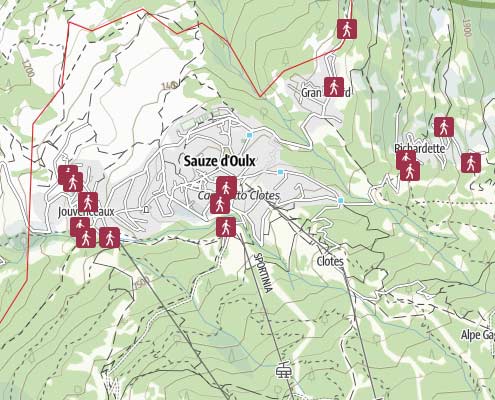
See the interactive off-road route map.

Strada dell’Assietta
Difficulty: moderate
Distance: 142.5 km
Duration: 5:00 h
Ascent: 4,765 m
Highest: 2,545m
Lowest: 484 m

Pramand & Colle del Sommeiller
Difficulty: moderate
Distance: 181 km
Duration: 7:50 h
Ascent: 6,087 m
Highest: 2,987 m
Lowest: 1,018 m

Valle Argentera & Monti della Luna
Difficulty: moderate
Distance: 100.4 km
Duration: 4:35 h
Ascent: 2,501 m
Highest: 2,416 m
Lowest: 1,245 m

A map showing off-road routes can be obtained directly from the Sauze d’Oulx Tourist Office.
Please note: seasonal restrictions are usually in effect on some roads. Please contact the Tourist Offices for updates or view the details tab in the interactive map for restrictions on routes.
In addition, the Fraternali maps 1- Alta Valle Susa (Bardonecchia, Oulx, Sauze d’Oulx, Salbertrand, Exilles, Chiomonte, Névache) along with Fraternali map 2 (Alta Valle Susa, Alta Val Chisone) may be of use.
Off-Road Videos
Val Susa AlpiTouRide Enduro/Maxienduro
Mont-Cenis – Jafferau – Sommelier – Bardonecchia – Assietta – Finestre
Images: Visit Piemonte
Link to: Bicycle Hire
Bike Hire
Rent your E-bike, Downhill, MTB in Sauze d’Oulx
Link to: Freeride
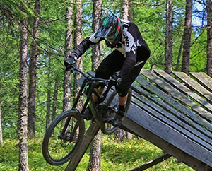
Freeride/Bike Park
Sauze Bike Park Information
Link to: Mountain Biking

Mountain Biking
Mountain Biking in Sauze d’Oulx
Link to: Hiking
Hiking
Hiking in the Mountains
Link to: Strada dell’Assietta
STRADA DELL’ASSIETTA
A wonderful trail for mountain bikers, hikers & more
Link to: Natural and landscape resources

GRAN BOSCO
The beautiful Gran Bosco Natural Park
Link to: Weather
Sauze Weather
Weather forecast for Sauze d’Oulx
Link to: Webcams
Sauze Webcams
Sauze d’Oulx & Vialattea Webcams
Link to: Hotels
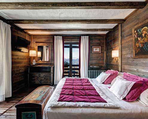
Sauze Hotels
Hotels in Sauze d’Oulx
Link to: Bicycle Hire
Bike Hire
Rent your E-bike, Downhill, MTB in Sauze d’Oulx
Link to: Freeride
Freeride/Bike Park
Sauze Bike Park Information
Link to: Mountain Biking
Mountain Biking
Sauze d’Oulx mountain bike
Link to: Hiking
Hiking
Expore Sauze’s hiking trails
Link to: Weather
Sauze Weather
Weather forecast for Sauze d’Oulx
Link to: Webcams
Sauze Webcams
Sauze d’Oulx & Vialattea Webcams